
Last Wednesday, after exploring downtown Buffalo I headed for the Canalside/Waterfront area.

This area is being regenerated, having at one time been a very busy port and the reason for Buffalo's prosperity in the 19th and early 20th centuries.

Now being promoted as an area for leisure and events, this is the site of the Erie Canal, opened in 1825 to link Lake Erie (which runs 65 miles west of Buffalo to Cleveland) with New York. The importance of this was that it opened up a route for grain from the Mid West farming states to be transported all over the world via the port of New York.

A few of the huge grain silos can still be seen in the harbour.

The boat trip took us out of the Harbour, past the naval museum and out onto Lake Erie.

We soon passed a quaint looking round building which is in fact one of the places where water is pumped out of the lake for use in the city.

Once out on the lake the boat turned and followed the Niagara River. Like Lake Erie, the river marks the border between Canada and the USA.

The Peace Bridge spans the river and flags at the Centre mark the border..

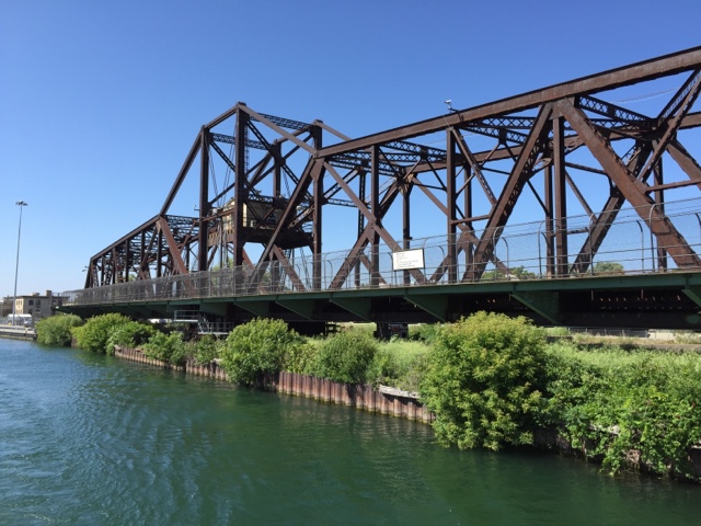
We travelled further up the river and then turned into part of an industrial canal which originally linked the Erie Canal to the lake.

The lock gates closed behind us..

Beyond the lock, bridges swung and lifted to let us through..

We were soon heading back to the Harbour and a view of some of the historic downtown buildings in Buffalo.

Looks like a good way to see everything.
ReplyDelete